
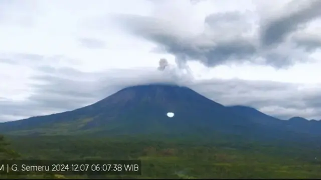
Lumajang-Semeru Mountain, located on the border of Lumajang Regency and Malang Regency, East Java, has erupted several times with no visual eruptions observed. Because the Mount Semeru area was covered in fog on Tuesday from 02:56 AM to 04:42 PM WIB
“An eruption of Mount Semeru occurred on Tuesday (10/12/2024) at 16:42 WIB, and the visual of the eruption was not observed,” said the Mount Semeru Observation Post Officer, Ghuforn Alwi, on Tuesday (10/12/2024).
Although the visual eruption of the mountain, which has an elevation of 3,676 meters above sea level (asl), was not observed, the eruption was still recorded on the seismograph with a maximum amplitude of 22 mm and a duration of 110 seconds.
Previously, there was also an eruption at 14:44 WIB with the visual eruption not observed, but the eruption was recorded on the seismograph with a maximum amplitude of 22 mm and a duration of 124 seconds.
Officers recorded that Mount Semeru experienced six eruptions with no visual observation of the eruptions, starting at 02:56 WIB, then at 10:21 WIB, followed by eruptions at 13:02 WIB, 13:33 WIB, and 16:42 WIB.
Ghufron said that Mount Semeru is still on alert status, so the Center for Volcanology and Geological Hazard Mitigation (PVMBG) has issued several recommendations, namely that the public is prohibited from carrying out any activities in the southeast sector along Besuk Kobokan up to eight kilometers from the summit. (pusat erupsi).
The public is not allowed to engage in activities 500 meters from the riverbank.

Outside that distance, the public is not allowed to engage in activities within 500 meters from the riverbank (river buffer zone) along Besuk Kobokan due to the potential for being affected by the expansion of hot clouds and lava flows up to 13 kilometers from the summit.
“The public is also prohibited from engaging in activities within a three-kilometer radius from the crater/summit of Mount Semeru, as it is prone to the danger of incandescent rock ejections,” he said.
In addition, the public needs to be wary of the potential for pyroclastic flows, lava flows, and rain-induced lahars along the river valleys that originate from the summit of Mount Semeru, especially along Besuk Kobokan, Besuk Bang, Besuk Kembar, and Besuk Sat, as well as the potential for lahars in the small rivers that are tributaries of Besuk Kobokan.


Leave a Reply